THE APP FOR GEOLOCALISED CENSUS
OF PUBLIC LIGHTING
INSTALLATIONS
READ MORE
The STARTING POINT
for the upgrading of the installations
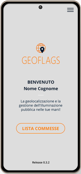
What does Geoflags do?
Geoflags is the practical and functional app that simplifies the census of public lighting installations by optimising the timing of surveying and data processing.
Who it is aimed at
The Geoflags app is aimed at technical offices, companies in the energy sector, public authorities and public administrations that are looking for a tool for the georeferenced survey of public lighting installations, as a basis for the energy upgrading of installations.
Geoflags is a flexible app that can also be used in other areas, e.g. for the census of smart city installations, trees and public green spaces, road signs, etc.
The STARTING POINT
for the upgrading of the installations
What does Geoflags do?
Geoflags is the practical and functional app that simplifies the census of public lighting installations by optimising the timing of surveying and data processing.
Who it is aimed at
The Geoflags app is aimed at technical offices, companies in the energy sector, public authorities and public administrations that are looking for a tool for the georeferenced survey of public lighting installations, as a basis for the energy upgrading of installations.
Geoflags is a flexible app that can also be used in other areas, e.g. for the census of smart city installations, trees and public green spaces, road signs, etc.
STRENGTHS
STRENGTHS
SPEEDOF
USE
The mapping work done by Geoflags is fast and functional, reduces analysis time and improves quality.
REAL
TIMEMAPPING
This allows public lighting installations to be surveyed in real time, optimising survey and data processing times.
TECHNICAL MANAGEMENTOF
ORDERS
Thanks to the practical panel, orders can be sorted and managed between the various operators.
OFFLINE
FUNCTIONALITY
The GPS system even operates when there is no connection. Data will be saved and restored by the app once it is reconnected to the network.
CUSTOMISED
TEMPLATES
The only app that allows the customisation of the census template of the surveyed devices and to carry out surveys according to the standards required by CONSIP LUCE 4 and CAM.
CLOUD-BASED
SHARING
The information collected will be displayed on the server and will be immediately visible to all users.
FUNCTIONS
Geolocalisation
Using satellite geolocalisation, the app allows the location of the point to be surveyed to be recorded on an interactive map.
On-Off Operation
In the event of a poor or non-existent 4G signal, GeoFlags operates off-line allowing the survey to run smoothly.
Data Sheet
Lighting point, panel, traffic light: each of these is associated with a template for entering all the necessary information.
Copying Data
The GeoFlags app makes it possible to duplicate data on different electric street lighting installations, to facilitate the entry of, for example, a series of identical lighting points.
FUNCTIONS
THE PANEL
The advanced capabilities of the GeoFlags App
The CMS panel has been specially designed to make the work of surveying public lighting electrical installations easier. This facilitates measures aimed at upgrading and improving energy efficiency.For this reason, the GeoFlags application has a number of advanced capabilities, such as order management, operator management and manual editing of surveyed devices.
- Customised Templates
By means of a special section within the control panel, it is possible to customise templates.
- Operator Management
Within the app there is the operator registry, which allows the assignment of individual operators to each job;
- Order Management
The application makes it easy and intuitive to edit and insert new devices;
- Importing Third Party Surveys
GeoFlags allows you to import third-party surveys into your database.
AREASFIND OUT MORE
of application
The GeoFlags application can be used in all areas of public lighting and more.
This innovative service lends itself to many different areas of application, thanks to the high reliability and accuracy of GPS localisation and the ability to manage a large amount of data via databases.
PUBLIC LIGHTING
SMART CITY
PUBLIC GREEN SPACES (coming soon)
Application dedicated to the georeferencing of lighting installations
- Lighting points
- Electrical panels
- Traffic lights
Application dedicated to the georeferencing of smart city devices
- APL - Pedestrian crossings
- SMP - Smart Parking Systems
- PAN-SM - Smart Benches
- TVCC-1 - Panoramic CCTV cameras
- TVCC-2 - Surveillance CCTV cameras
- STAZIONI METEO - Environmental Parameter Control
- TAI-FAI - Adaptive Lighting
- SRB-AUT - Electric car charging stations
- SRB-BIC - Electric bicycle charging stations
- WI-FI - WI-FI hotspots
- TOT-SM - Smart Totem
Application dedicated to the georeferencing of public green spaces
- Trees
- Bushes
- Flowerbeds
Fill the FORM
© COPYRIGHT - Privacy Policy - Cookie Policy - Preferenze Cookies